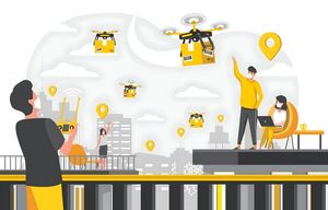
The concept known as Drone-as-a-Service in enterprises refers to a business model in which organizations use remotely operated aircraft systems through an external operational arrangement rather than maintaining their own drone fleets. Instead of building internal drone infrastructure, companies access drone capabilities such as aerial mapping, monitoring, and inspection through specialized operational providers.
Unmanned aerial vehicles, often called drones, were initially developed for research and defense activities. Over time, improvements in sensors, navigation systems, and battery technology made these aircraft useful in many civilian industries. Businesses began exploring how aerial data could support tasks that were traditionally slow, risky, or difficult to monitor from the ground.
As industries expanded their use of aerial data collection, the Drone-as-a-Service model emerged. This approach allows organizations to focus on interpreting aerial information rather than managing hardware, training pilots, or maintaining flight systems. The concept is particularly relevant for enterprises that require occasional or large-scale aerial monitoring.
Several sectors now integrate this approach into routine operations. Examples include agriculture monitoring, infrastructure inspection, construction progress tracking, environmental research, and logistics planning. The model continues to evolve as aviation authorities establish clearer operational frameworks and industries recognize the value of aerial intelligence.
Understanding the basics of Drone-as-a-Service in enterprises helps readers see how aerial technology fits into modern digital ecosystems. It also explains why many industries view drone data as a practical tool for observation and analysis.
Importance
The growing interest in Drone-as-a-Service in enterprises reflects a broader shift toward data-driven decision-making. Organizations increasingly rely on real-time information to understand physical environments, manage infrastructure, and evaluate operational progress.
Traditional inspection or monitoring methods often require manual field visits. These activities can be time-consuming and may involve safety risks when workers must access tall structures, hazardous terrain, or remote locations. Drone technology provides an aerial perspective that allows organizations to observe large areas more efficiently.
Several practical challenges make aerial monitoring useful:
- Infrastructure inspection: Bridges, transmission lines, pipelines, and towers require periodic examination to detect damage or wear.
- Construction monitoring: Project managers track building progress, site conditions, and equipment movement.
- Agriculture observation: Farmers analyze crop health, irrigation patterns, and soil conditions across large fields.
- Environmental monitoring: Researchers examine forest cover, water bodies, and wildlife habitats.
- Emergency assessment: Authorities review disaster-affected areas without placing personnel in dangerous environments.
Enterprises benefit from aerial imagery, geospatial mapping, and environmental data that drones collect. This information can help organizations identify patterns that are difficult to observe at ground level.
Another important factor is scalability. A single enterprise project may require aerial monitoring across multiple locations. The Drone-as-a-Service model allows organizations to access operational capacity when needed without building a dedicated aviation team internally.
In addition, many industries are undergoing digital transformation. Drone data can integrate with geographic information systems (GIS), artificial intelligence tools, and cloud-based analytics platforms. This integration allows companies to combine aerial observations with other datasets to understand trends and operational conditions.
For these reasons, Drone-as-a-Service in enterprises has become an important topic in discussions about automation, digital infrastructure, and remote monitoring technologies.
Recent Updates
Between 2024 and 2026, several developments influenced the expansion of Drone-as-a-Service in enterprises. Improvements in drone hardware, data processing tools, and regulatory clarity contributed to wider adoption across industries.
One major trend involves the integration of drones with automated data analysis. Artificial intelligence systems can process aerial images to detect structural changes, vegetation patterns, or environmental variations. These tools help organizations transform raw imagery into actionable insights.
Another development relates to drone flight endurance and sensor capabilities. Advances in battery technology and lightweight materials allow drones to remain airborne longer and carry advanced imaging devices. Many modern drones include thermal cameras, multispectral sensors, and LiDAR scanning systems.
The following table illustrates common enterprise applications and the type of data collected through drone operations.
| Industry Sector | Typical Drone Activity | Data Collected |
|---|---|---|
| Agriculture | Crop field monitoring | Plant health imagery, soil moisture indicators |
| Construction | Site mapping and progress tracking | 3D terrain models, structural measurements |
| Energy Infrastructure | Power line and pipeline inspection | Thermal imaging, structural visuals |
| Mining | Land surveying and stockpile analysis | Topographic maps, volume measurements |
| Environmental Research | Habitat monitoring | Vegetation density, wildlife patterns |
Automation has also become a key area of progress. Some drone systems now support pre-programmed flight paths that allow consistent aerial surveys over large territories. These automated missions help produce comparable datasets over time.
Another trend involves integration with enterprise data platforms. Organizations increasingly combine drone imagery with geographic mapping software and digital twin models. These digital representations help simulate physical environments and track infrastructure changes.
International aviation authorities have also introduced clearer operational guidelines. These frameworks address airspace usage, pilot certification, and flight permissions. Such policies help organizations understand how drone operations can be conducted safely within national airspace systems.
Overall, the period between 2024 and 2026 reflects gradual maturation of the drone ecosystem. Enterprises now view aerial data not simply as visual imagery but as a component of digital infrastructure analysis.
Laws or Policies
Drone operations are regulated in most countries to maintain aviation safety and protect public privacy. Enterprises interested in Drone-as-a-Service activities must operate within the legal frameworks established by aviation authorities.
In India, drone regulations are overseen by the Directorate General of Civil Aviation. The government introduced the Drone Rules 2021 to simplify the regulatory structure for unmanned aircraft operations.
These rules establish several key requirements:
- Drone classification: Aircraft are categorized by weight and operational capabilities.
- Pilot certification: Individuals operating drones must complete approved training and obtain certification.
- Digital registration: Drones must be registered on the national digital platform known as Digital Sky Platform.
- Operational zones: Airspace is divided into green, yellow, and red zones indicating where drone flights are permitted or restricted.
- Remote identification: Many drones must transmit identification information to authorities for monitoring purposes.
The Indian government has also launched initiatives that encourage responsible drone adoption in sectors such as agriculture, mapping, and infrastructure monitoring. These programs emphasize safety compliance and data management practices.
Privacy considerations also influence drone regulations. Operators must ensure that aerial imaging does not violate personal privacy or capture restricted locations without authorization.
Internationally, organizations such as the International Civil Aviation Organization publish recommendations that guide national aviation authorities when developing drone policies.
Enterprises working with drone operations must remain aware of evolving aviation rules, airspace permissions, and data protection regulations.
Tools and Resources
Several digital platforms and analytical tools support enterprises that use drone data. These tools help manage flight planning, aerial mapping, and data interpretation.
Geospatial mapping software plays an important role in drone-based analysis. Programs such as ArcGIS allow organizations to visualize aerial imagery alongside geographic datasets. This helps users analyze terrain features, infrastructure locations, and environmental changes.
Another widely used platform is DroneDeploy, which processes aerial photographs into maps and three-dimensional models. These outputs help organizations interpret structural details and terrain variations.
Flight planning and drone management tools are also essential. Software such as DJI Terra supports route planning and automated aerial mapping workflows.
Enterprises often combine drone data with remote sensing tools. Platforms like Google Earth Engine enable large-scale environmental analysis using satellite and aerial imagery.
Common digital resources used alongside drone operations include:
- Geographic Information Systems (GIS): Tools for mapping and spatial analysis
- Photogrammetry software: Converts overlapping aerial images into 3D models
- Cloud data platforms: Store and process large volumes of aerial imagery
- Environmental monitoring databases: Provide historical geographic data for comparison
- Regulatory portals: Manage drone registration and airspace permissions
Educational resources are also widely available. Universities, aviation institutions, and online learning platforms publish training materials that explain drone technology, flight safety, and geospatial data analysis.
These tools and resources help enterprises transform aerial imagery into meaningful datasets that support operational decisions.
FAQs
What is Drone-as-a-Service in enterprises?
Drone-as-a-Service in enterprises refers to a model where organizations access drone operations and aerial data through specialized operational arrangements rather than maintaining their own drone fleets and aviation teams.
How do enterprises use Drone-as-a-Service technology?
Enterprises use drone-based aerial data for tasks such as infrastructure inspection, agricultural observation, construction monitoring, environmental surveys, and geographic mapping.
Is Drone-as-a-Service regulated in India?
Yes. Drone operations in India follow aviation regulations issued by the Directorate General of Civil Aviation. Aircraft registration, pilot certification, and airspace permissions are managed through the Digital Sky platform.
What types of data do drones collect for enterprises?
Enterprise drones gather several forms of information, including aerial photographs, thermal imagery, multispectral crop data, terrain measurements, and three-dimensional structural models.
Why are enterprises interested in Drone-as-a-Service models?
Many organizations explore this approach because aerial data can improve situational awareness, help analyze physical environments, and support digital mapping activities without building extensive internal drone infrastructure.
Conclusion
Drone-as-a-Service in enterprises represents an evolving approach to using aerial technology for data collection and environmental observation. Advances in sensors, mapping software, and aviation regulation have expanded the role of drones across multiple industries. Enterprises increasingly use aerial imagery and geospatial analysis to monitor infrastructure, analyze land conditions, and observe large operational areas. As regulatory frameworks and digital tools continue to develop, drone-based data collection is likely to remain part of modern enterprise technology ecosystems.